Schotse Hooglanden & Speyside
 Wandelkaart Fannichs Seana Bhraigh & Ben Wyvis | Harvey Maps
Detailed map for hillwalkers of the Fannichs ridge at the popular 1:25,000 scale. This is an area located to the south of Ullapool and to the west of Dingwall. Includes …
 Wandelkaart Rum, Eigg, Canna, Muck | Harvey Maps
More than "just" a map, this map is an essential piece of equipment, this new generation of HARVEY Superwalkers is designed to be the most practical tool for navigation outdoors. …
 Wandelkaart Suilven / Stac Pollaidh & Ben More Assynt harve | Harvey Maps
Suilven covers the spectacular group of remote northerly munros popular with walkers and climbers. The map area includes Suilven, Canisp, CulMor,Breabag Stac Pollaidh, Conival & Ben More Assynt. This map …
 Wandelkaart Knoydart / Kintail / Glen Shiel harvey | Harvey Maps
This remote and beautiful area is often known as 'Scotland's last wilderness'. Detailed map for hillwalkers of Knoydart and Glen Shiel at the popular scale of 1:25,000. Includes …
 Wandelkaart Pitlochry Loch Tummel & Blair Atholl | Harvey Maps
Detailed map for hillwalkers of Pitlochry, Loch Tummel and Blair Atholl at the popular 1:25,000 scale. Includes Ben Vrackie, Beinn a’ Ghlo and Pass of Killiecrankie. Shows Aberfeldy in …
 Wandelkaart Ben Alder | Harvey Maps
Covers a large area yet is handily compact. Pocket perfect!Detailed map for runners and walkers of the hills between Loch Tay and Loch Rannoch at the magic scale of 1:40,000.Includes …
 Wandelkaart Ben Lawers & Schiehallion | Harvey Maps
40 years’ experience have gone into HARVEY’s most creative new series. Slim and light, the Ultramap covers a large area and yet is handily compact. Pocket perfect! Includes Ben …
 Wandelkaart Loch Monar | Harvey Maps
40 years’ experience have gone into HARVEY’s most creative new series. Slim and light, the Ultramap covers a large area and yet is handily compact. Pocket perfect! The Ultramap …
 Wandelkaart Suilven / Stac Pollaidh / Lochinver | Harvey Maps
Detailed map for runners and walkers of Suilven and the surrounding area at the magic scale of 1:40,000. Covers a large area yet is handily compact. Pocket perfect! This is …
 Wandelkaart Torridon | Harvey Maps
Covers a large area yet is handily compact. Pocket perfect!Includes Slioch, Beinn Eighe, Liathach and Beinn Alligin.Detailed map for runners and walkers of the Torridon Hills at the magic scale …
 Wandelkaart Glen Coe | Harvey Maps
Covers a large area yet is handily compact. Pocket perfect! Detailed map for runners and walkers of Glen Coe and the Aonach Eagach ridge at the magic scale of …
 Wandelkaart Loch Earn | Harvey Maps
Covers a large area yet is handily compact. Pocket perfect! Detailed map for runners and walkers of Loch Earn, Glen Ogle and Killin at the magic scale of 1:40,000. …
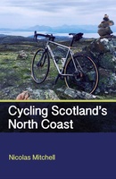 Fietsgids Cycling Scotland's North Coast | Crowood
Beschrijving van de route is zeer gedetailleerd, kaartmateriaal is minder, het zijn slechts schetsen. This cycling guidebook follows the course of a new cycling route around the North Coast of …
 Wandelkaart Glen Affric | Harvey Maps
Covers a large area yet is handily compact. Pocket perfect! Detailed map for runners and walkers of the remote Glen Affric area at the magic scale of 1:40,000. …
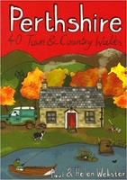 Wandelgids Perthshire : 40 Town and Country Walks | Pocket Mountains
Handige compacte wandelgids met 40 dagwandelingen. Deze gids bevat kleine kaartjes en leuke uitgebreide informatie over wat er langs de route te zien is. Goede wandelkaarten zijn echter we noodzakelijk …
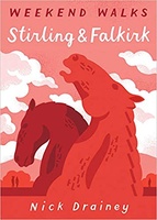 Wandelgids Stirling & Falkirk : Weekend Walks | Pocket Mountains
Handige compacte wandelgids met 40 dagwandelingen. Deze gids bevat kleine kaartjes en leuke uitgebreide informatie over wat er langs de route te zien is. Goede wandelkaarten zijn echter we noodzakelijk …
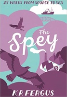 Wandelgids The Spey | Pocket Mountains
Handige compacte wandelgids met 40 dagwandelingen. Deze gids bevat kleine kaartjes en leuke uitgebreide informatie over wat er langs de route te zien is. Goede wandelkaarten zijn echter we noodzakelijk …
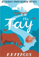 Wandelgids The Tay | Pocket Mountains
Handige compacte wandelgids met 40 dagwandelingen. Deze gids bevat kleine kaartjes en leuke uitgebreide informatie over wat er langs de route te zien is. Goede wandelkaarten zijn echter we noodzakelijk …
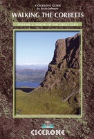 Wandelgids 2 Walking the Corbetts: Volume 2 | Cicerone
Uitstekende wandelgids, goed beschreven met veel praktische informatie om de route te kunnen lopen, inclusief redelijke kaarten. This guide describes routes up all 109 Corbetts north of the Great Glen. …
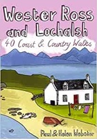 Wandelgids Wester Ross and Lochalsh | Pocket Mountains
Handige compacte wandelgids met 40 dagwandelingen. Deze gids bevat kleine kaartjes en leuke uitgebreide informatie over wat er langs de route te zien is. Goede wandelkaarten zijn echter we noodzakelijk …
Laatste reviews

De landkaart 363 Puglia van Michelin is voor wat betreft duidelijkheid naar mijn mening de beste die er voor deze regio is. Zeer bruikbare kaart!
★★★★★ door J.H.A. Mohr 14 november 2024 | Heeft dit artikel gekocht
Ik vind de kaart erg handig.
★★★★★ door Leo van Geene 14 november 2024 | Heeft dit artikel gekocht
Heerlijke kaart om routes op uit te stippelen. Groot en duidelijk, en waterbestendig! Heel blij mee.
★★★★★ door Annemiek 14 november 2024 | Heeft dit artikel gekocht
Snel geleverd en één vd weinige winkels in NL waar ze deze paspoorten verkopen.
★★★★★ door Eline 12 november 2024 | Heeft dit artikel gekocht

