Kaarten - Ierland
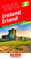 Wegenkaart - landkaart Ireland - Ierland | Hallwag
Ondanks de soms wat grove schaal bevatten deze kaarten van Hallwag zeer veel detail/plaatsnamen. Ook de treinlijnen/stations staan hierop zeer duidelijk aangegeven, evenals campings. Dit maakt deze kaarten zeer geschikt …
 Wegenkaart - landkaart Ireland North ( Ierland ) | Ordnance Survey Ireland
Hele duidelijke kaarten van een groot gebied: Ierland is in vieren gedeeld. Met alle noodzakelijke informatie, bijna topografisch van aard. Campings en bezienswaardigheden zijn er o.a. op terug te vinden! …
 Wegenkaart - landkaart Ireland East ( Ierland ) | Ordnance Survey Ireland
Hele duidelijke kaarten van een groot gebied: Ierland is in vieren gedeeld. Met alle noodzakelijke informatie, bijna topografisch van aard. Campings en bezienswaardigheden zijn er o.a. op terug te vinden! …
★★★★★ Wegenkaart - landkaart Ireland South ( Ierland ) | Ordnance Survey Ireland
Hele duidelijke kaarten van een groot gebied: Ierland is in vieren gedeeld. Met alle noodzakelijke informatie, bijna topografisch van aard. Campings en bezienswaardigheden zijn er o.a. op terug te vinden! …
★★★★★★★★★★ Wegenkaart - landkaart Groot-Brittanië en Ierland | ANWB Media
De ANWB heeft een grote serie wegenkaarten van de belangrijkste landen en streken. Het zijn echte overzichtskaarten van vaak een wat groter gebied. Deze keuze zorgt er voor dat de …
★★★★★ Stadsplattegrond Dublin | Borch
Borch Dublin is een duidelijke, geplastificeerde plattegrond van het centrum met informatie over openbaar vervoer en bezienswaardigheden. Inclusief straatnamenregister. Our soft-laminated folded map of Dublin shows: Central Dublin 1:12 000, …
★★★★★ Wegenkaart - landkaart Ireland driving map | Ordnance Survey Ireland
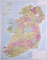 Wegenkaart - landkaart Ierland administratief | 76 x 97 cm | Lascelles
 Wegenkaart - landkaart Great Britain, Ireland - Groot-Brittannië / Ierland | ExpressMap
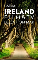 Wegenkaart - landkaart Pocket Map Ireland Film and TV Location Map | Collins
Full-colour, handy guide to more than 50 of the most popular film and TV locations in Ireland. Striking images and detailed descriptions allow for a comprehensive guide to Ireland's most …
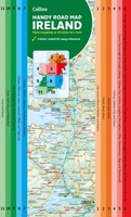 Wegenkaart - landkaart Map of Ireland Handy | Collins
Explore new places with this comprehensive map of Ireland from Collins. An easy-to-use route-planning map covering the whole of Ireland. It has the convenience of an atlas with all the …
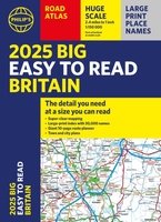 Wegenatlas Philip's Easy to Read Road Atlas of Britain 2025 | A3-Formaat | Paperback | Philip's Maps
With the detail you need at a size you can read, the latest edition of 2025 Philip's Big Easy to Read Road Atlas of Britain is super-clear, super-sized and bang …
 Wegenkaart - landkaart Ierland | ITMB
As technology improves, we are able to produce more detailed maps than was previously possible. Such is the case with Ireland, a part of the world consisting of two countries …
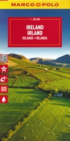 Wegenkaart - landkaart Ierland - Ireland | Marco Polo
Duidelijke wegenkaart van Marco Polo: alle wegen, zowel de verharde als belangrijke onverharde wegen zijn weergegeven. Mooie toeristisch interessante wegen die de moeite waard zijn, zijn groen gearceerd. Veel toeristische …
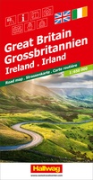 Wegenkaart - landkaart Grossbritannien, Irland - Groot Britannie, Ierland | Hallwag
Prima kaart van heel Groot Brittannie en Ierland , dubbelzijdig bedrukt met plaatsnamen index. Road map Great Britain / Ireland Road map with transit plans, location index, tourist information and …
 Wegenkaart - landkaart Planning Map Ireland | Lonely Planet
Durable and waterproof, with a handy slipcase and an easy-fold format, Lonely Planet's Ireland Planning Map is your essential navigation tool. This full-colour map features accompanying images and information …
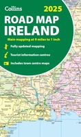 Wegenkaart - landkaart Ireland - Ierland road map 2025 | Collins
Explore Ireland with easy-to-read mapping from Collins. Full-color map of Ireland at 9 miles to 1 inch (1:570,240), with clear, detailed road network and counties and new administrative areas shown …
 Wandelkaart Dingle Peninsula | Harvey Maps
The whole of the Dingle Peninsula on one lightweight, waterproof map at the popular 1:30,000 scale. Includes Mount Brandon and the entire Brandon Group of mountains in the west …
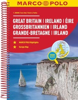 Wegenatlas Groot Brittannie & Ierland | Marco Polo
Goede wegenatlas met gedetailleerde kaarten. Alle wegen staan erop vermeldt plus onverharde wegen. Pittoreske weggetjes die de moeite waard zijn, zijn groen gearceerd. Alle toeristische informatie, ook campings zijn er …
 Stadsplattegrond Discovery Cork city | Ordnance Survey Ireland
Laatste reviews

Kan de huidige ontstuimige ontwikkelingen wereldwijd, nu ook geografisch plaatsen en daarmee beter volgen.
★★★★★ door Leo Janssen 20 december 2024 | Heeft dit artikel gekocht
We hadden Piëmonte al eens bezocht en voor onze komende reis werd ons door kennissen deze gids aanbevolen. Inderdaad is dit een heel goede gids. …
★★★★★ door DWKdB 19 december 2024 | Heeft dit artikel gekocht
Mijn bestellingen zijn altijd goed en worden altijd op tijd geleverd. Komen afspraken goed na. Erg tevreden.
★★★★★ door Ben Wegdam 19 december 2024 | Heeft dit artikel gekocht
Zeer gedetailleerde kaart van het zuidelijke deel van het douaniers pad
★★★★★ door Marian 18 december 2024 | Heeft dit artikel gekocht

