Wandelgidsen - South West England
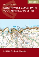 Wandelgids South West Coast Path Map Booklet | Cicerone
A booklet of all the mapping needed to walk the South West Coast Path between Minehead and St Ives. Covering the northern section of this 1014km (630 mile) National Trail …
 Wandelgids Sarsen Way Walking | Cicerone
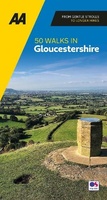 Wandelgids 50 Walks in Gloucestershire | AA Publishing
 Wandelgids Day Walks in Somerset | Vertebrate Publishing
Day Walks in Somerset features 20 routes between 7 and 15 miles (11km and 24km) in length, spread across the county of Somerset, including the Exmoor National Park. Researched and …
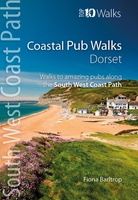 Wandelgids Coastal Pub Walks: Dorset | Northern Eye Books
Dorset’s best coastal pub walks The excellent pubs along the Dorset coast complement the walking on this superlative stretch of the South West Coast Path. Each walk incorporates a stretch …
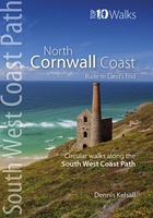 Wandelgids North Cornwall Coast | Northern Eye Books
Bude to Land’s End The ten walking routes featured here highlight the best short circular walks along the North Cornwall Coast section of the popular, 630-mile long South West Coast …
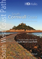 Wandelgids South Cornwall Coast | Northern Eye Books
Land’s End to Plymouth The ten walking routes featured here highlight the best short circular walks along the South Cornwall Coast section of the popular, 630-mile long South West Coast …
 Wandelgids South Devon Coast | Northern Eye Books
Plymouth to Lyme Regis The ten walking routes featured here highlight the best short circular walks along the South Devon Coast section of the popular, 630-mile long South West Coast …
 Wandelgids Coastal Pub Walks: South Devon | Northern Eye Books
South Devon’s best coastal pub walks The lovely pubs along the South Devon coast complement the walking on this superlative stretch of the South West Coast Path. Each walk incorporates …
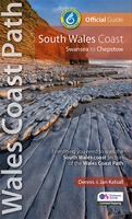 Wandelgids Wales Coast Path | Northern Eye Books
One of seven Official Guides to the Wales Coast Path The 115 mile/185km long South Wales Coast section of the Wales Coast Path runs through unexpectedly varied and dramatic …
 Wandelgids Cotswolds | Ordnance Survey
Explore ten easy-paced, family-friendly short walks across the Cotswolds Area of Outstanding Natural Beauty. Originating from a Saxon term meaning ‘wooded hollows, amid gentle hills’, the AONB straddles six counties, …
 Wandelgids Weekend Walks Brighton and the South Downs | Pocket Mountains
Facing the sea and backed by rolling chalk downland, Brighton is a great place from which to explore one of England's most recognisable and best-loved landscapes. As well as the …
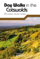 Wandelgids Day Walks in the Cotswolds | Vertebrate Publishing
Day Walks in the Cotswolds features 20 circular routes, between 7.1 and 12.6 miles (11.5km and 20.2km), suitable for hillwalkers of all abilities. Split across three areas - North-East Cotswolds, …
 Wandelgids Day Walks in Devon | Vertebrate Publishing
Day Walks in Devon features 20 circular routes, between 8.8 and 17.6 miles (14.1km and 28.3km), suitable for hillwalkers of all abilities. The routes are split into five geographical areas: …
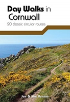 Wandelgids Day Walks in Cornwall | Vertebrate Publishing
Day Walks in Cornwall features 20 circular routes between 7.2 and 13.7 miles (11.6km and 22km) in length, suitable for hillwalkers of all abilities. Researched and written by experienced authors …
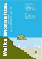 Wandelgids Ilfracombe to Padstow | Hallewell Publications
Walks Ilfracombe to Padstow features a selection of the best short walks from the section of South West Coast Path which runs between the towns of Ilfracombe in the north …
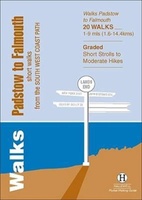 Wandelgids Padstow to Falmouth | Hallewell Publications
Walks Padstow to Falmouth features a selection of the best short walks from the section of South West Coast Path which runs between the towns of Padstow in the north …
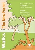 Wandelgids the New Forest | Hallewell Publications
Walks Malham & The Three Peaks is part of a popular series of A6 pocket walking guides which describe routes which are suitable for walkers of all abilities and to …
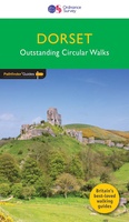 Wandelgids 011 Pathfinder Guides Dorset | Ordnance Survey
Wandelgids van een deel van Engeland. Deze gids bevat 28 dagwandelingen, variërend van korte tochten tot pittige dagtochten. De bijbehorende kaarten zijn uitstekend: men heeft de topografische kaarten van Ordnance …
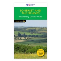 Wandelgids 076 Pathfinder Guides Somerset & the Mendips | Ordnance Survey
Wandelgids van een deel van Engeland. Deze gids bevat 28 dagwandelingen, variërend van korte tochten tot pittige dagtochten. De bijbehorende kaarten zijn uitstekend: men heeft de topografische kaarten van Ordnance …
Laatste reviews

Kan de huidige ontstuimige ontwikkelingen wereldwijd, nu ook geografisch plaatsen en daarmee beter volgen.
★★★★★ door Leo Janssen 20 december 2024 | Heeft dit artikel gekocht
We hadden Piëmonte al eens bezocht en voor onze komende reis werd ons door kennissen deze gids aanbevolen. Inderdaad is dit een heel goede gids. …
★★★★★ door DWKdB 19 december 2024 | Heeft dit artikel gekocht
Mijn bestellingen zijn altijd goed en worden altijd op tijd geleverd. Komen afspraken goed na. Erg tevreden.
★★★★★ door Ben Wegdam 19 december 2024 | Heeft dit artikel gekocht
Zeer gedetailleerde kaart van het zuidelijke deel van het douaniers pad
★★★★★ door Marian 18 december 2024 | Heeft dit artikel gekocht

