National Geographic
Dit bekende tv-kanaal heeft naast prachtige natuurdocumontaires en magazines ook zijn eigen reisgidsen en wegenkaarten uitgegeven. De landkaarten zijn gedrukt op scheurvast en waterbestendig papier wat een vergrootte levensduur betekent. De kaarten zijn helder en bevatten een schat aan informatie voor zowel de 'gewone' toerist als de avonturier. De hoofdwegen zijn duidelijk aangegeven, maar ook de secundaire wegen en tracks staan er op. Met de nationale parken duidelijk en mooie zwemplekken of attracties aangegeven onderscheidt deze kaartenserie zich van de andere wegenkaarten. De kaarten heten dan ook niet voor niets Adventure Maps! Het avontuur wacht!
 Wandelgids 1510 Topographic Map Guide Appalachian Trail – East Mountain to Hanover | National Geographic
Wandelgids/wandelatlas met weinig tekst, maar goede kaarten van een gedeelte van de Appalachian Trail. Each A.T. Topographic Map Guide includes detailed topographic maps at a detail of 1 inch = …
 Wandelgids 1511 Topographic Map Guide Appalachian Trail – Hanover to Mount Carlo | National Geographic
Wandelgids/wandelatlas met weinig tekst, maar goede kaarten van een gedeelte van de Appalachian Trail. Each A.T. Topographic Map Guide includes detailed topographic maps at a detail of 1 inch = …
 Wandelgids 1512 Topographic Map Guide Appalachian Trail – Mount Carlo to Pleasant Pond | National Geographic
Wandelgids/wandelatlas met weinig tekst, maar goede kaarten van een gedeelte van de Appalachian Trail. Each A.T. Topographic Map Guide includes detailed topographic maps at a detail of 1 inch = …
 Wandelgids 1513 Topographic Map Guide Appalachian Trail – Pleasant Pond to Katahdin | National Geographic
Wandelgids/wandelatlas met weinig tekst, maar goede kaarten van een gedeelte van de Appalachian Trail. Each A.T. Topographic Map Guide includes detailed topographic maps at a detail of 1 inch = …
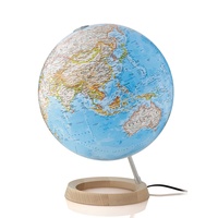 Wereldbol - Globe 17 Neon Classic ø 30 cm | Nederlandstalig | Met Verlichting | National Geographic
Deze National Geographic Neon Blauw wereldbol is een van de favoriete globes voor scholen en hogere onderwijsinstellingen. Dit is te danken aan het neutrale, maar toch sierlijke uiterlijk van het …
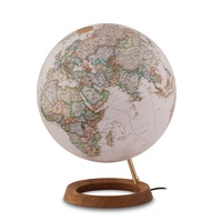 Wereldbol - Globe 18 Neon Executive ø 30 cm | Nederlandstalig | Met Verlichting | National Geographic
Deze National Geographic Neon Executive wereldbol is een van de favoriete globes voor scholen en hogere onderwijsinstellingen. Dit is te danken aan het neutrale, maar toch sierlijke uiterlijk van het …
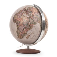 Klassieke wereldbol 19 Fusion Executive | Ø 37 cm | Engelstalig | met Verlichting | National Geographic
Op de Fusion Executive globe van National Geographic staan meer dan 2000 geografische namen. De bol heeft een klassieke, antieke uitstraling met een recente politieke indeling gebaseerd op de prijswinnende …
 Wandelatlas 2 Grande traversata delle Alpi - GTA Centro | National Geographic
De GTA, Great Crossing of the Alps, is een wandelroute die de hele westelijke Alpenboog van Piemonte en Ligurië/Frankrijk verenigt en is opgedeeld in een dicht netwerk van paden en …
 Wandelkaart 200 Rocky Mountain National Park | National Geographic
Zeer gedetailleerde wandel- en trekkingkaart voor het Rocky Mountain Nationaal Park in Colorado. Met ingetekende wandelroutes, afstanden, kampeerplekken en toeristische informatie en vele handige tips. GPS geschikt door UTM Grid. …
★★★★★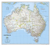 Wandkaart 20002 Australië, politiek, 77 x 69 cm | National Geographic
Highly accurate Australia political map clearly shows state boundaries, place names, bodies of water, parks and preserves, and more. Includes inset maps for Tasmania and major Australian cities.
★★★★★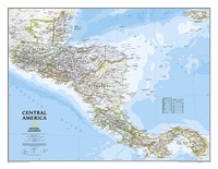 Wandkaart 20011 Centraal Amerika, 73 x 55 cm | National Geographic
This Central America Wall Map by National Geographic contains extensive political information with political boundaries clearly presented with different color-bands for each country. Beautifully shaded to show physical terrain, this …
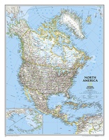 Wandkaart 20014 Noord Amerika, politiek, 60 x 77 cm | National Geographic
The political map of North America features trademark National Geographic detail and accuracy. The map shows country boundaries, place names, major highways and roads, bodies of water, and more. An …
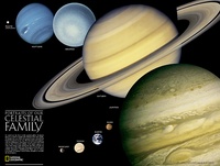 Poster 20021 Zonnestelsel | 62 x 46 cm | National Geographic
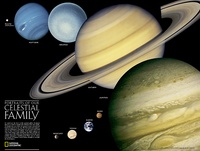 Poster 20021 Zonnestelsel | 62 x 46 cm | National Geographic
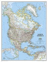 Wandkaart 20035 Noord Amerika, politiek, 91 x 118 cm | National Geographic
The political map of North America features trademark National Geographic detail and accuracy. The map shows country boundaries, place names, major highways and roads, bodies of water, and more. An …
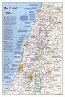 Wandkaart 20044 Holy Land – Israël, 53 x 80 cm | National Geographic
National Geographic Wall Maps offer a special glimpse into current and historical events, and they inform about the world and environment. Offered in a variety of styles and formats, these …
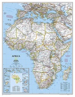 Wandkaart 20052 Afrika, politiek, 91 x 118 cm | National Geographic
Mooie wandkaart van Afrika, staatkundig, met rustig kleurgebruik en helder kaartbeeld, Ondanks het wat kleiner formaat staan er toch heel wat topografische details op vermeld. The map presents …
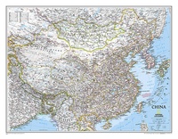 Wandkaart 20057 China, 76 x 59 cm | National Geographic
Decoratieve wandkaart van China. Naast de mooie kleuren staan er bijzonder veel plaatsen op vermeld. Het gaat soms een beetje ten kosten van de schoonheid van de kaart, maar daardoor …
★★★★★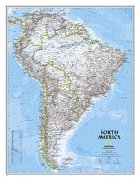 Wandkaart 20069 Zuid Amerika, politiek, 54 x 74 cm | National Geographic
This classic map of South America shows political boundaries, place names, airports, major roads and highways, and other geographic features for the entire continent.
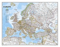 Wandkaart 20070 Europa, politiek, 77 x 60 cm | National Geographic
This colorful Europe political map clearly shows country boundaries, capitals, many major cities, bodies of water, airports, major highways and roads, and much more.
Laatste reviews

Kan de huidige ontstuimige ontwikkelingen wereldwijd, nu ook geografisch plaatsen en daarmee beter volgen.
★★★★★ door Leo Janssen 20 december 2024 | Heeft dit artikel gekocht
We hadden Piëmonte al eens bezocht en voor onze komende reis werd ons door kennissen deze gids aanbevolen. Inderdaad is dit een heel goede gids. …
★★★★★ door DWKdB 19 december 2024 | Heeft dit artikel gekocht
Mijn bestellingen zijn altijd goed en worden altijd op tijd geleverd. Komen afspraken goed na. Erg tevreden.
★★★★★ door Ben Wegdam 19 december 2024 | Heeft dit artikel gekocht
Zeer gedetailleerde kaart van het zuidelijke deel van het douaniers pad
★★★★★ door Marian 18 december 2024 | Heeft dit artikel gekocht

