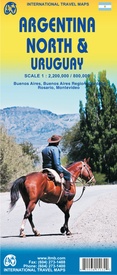
Een degelijke kaart met aanduidingen van o.a. nationale parken, vliegveld, benzinepomp, dirt-roads en kleine plattegrond van hoofdstad. Als overzichtskaart goed te gebruiken.
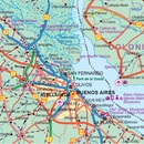
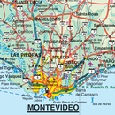
At ITMB, we are excited to present our first attempt of combining Argentina North and Uruguay on a travel map. For our map of Argentina North, we have display significant updating of the road network. Argentina is aggressively redeveloping the country's infrastructure, investing in new schools, hospitals, and water supplies, as well as paving hundreds of kilometres of dirt highways annually. No map can be completely up to date as a result, as new segments of newly-paved roadway comes 'on stream' weekly; however, we've done our best to show off this fast-changing country to good advantage. Our 4th edition Uruguay map mostly contains minor updates to the layout of the previous edition. We have added an inset of the capital Montevideo as well. Uruguay is still one of the most economically developed countries in South America. And with it also being one of the most liveable and greenest countries, Uruguay makes a great travel destination. Insets include: Buenos Aires, Buenos Aires Region, Cordoba, Rosario, Montevideo, Punta Del Este, and Colonia Del Sacramento.
Argentinia 1:2.200.000
Uruguay 1:800.000
Legend Includes:
Roads by classification, Airports, Ferries, Train Stations, Bus Terminals, Subway Stations, Lighthouses, Beaches, Ruins, Hot Springs, Border Crossings, Points of Interest, Police Stations, Gas Stations, Museums, Churches, Post Offices, Department Stores, Theatres, Restaurants, Hospitals and more.


