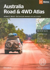
Wegenatlas Australia - Road en 4WD Atlas - Australie | Hema Maps (9781876413774)
Most detailed atlas ever
- ISBN / CODE: 9781876413774
- Editie: 01-12-2017
- Druk: 12
- Aantal blz.: 208
- Uitgever: Hema Maps
- Soort: Wegenatlas
- Taal: Engels
- Hoogte: 35.0 cm
- Breedte: 25.0 cm
- Dikte: 1.5 cm
- Gewicht: 1351.0 g
- Bindwijze: Paperback
- Uitvoering: Papier
- Druk: 12
- Schrijf als eerste een review
-
€ 30,95
Leverbaar in 3 - 5 werkdagen in huis in Nederland Levertijd Belgie
Gratis verzending in Nederland vanaf €35,-
Beschrijving
Gebonden versie, geen spriraalbinding leverbaar van deze atlas. Schaal is variabel per kaart.
Deze editie bevat meer kaarten dan ooit tevoren,met t verneiuwd klerugebruik en daardor nog beter leesbaar.. Met detailkaarten voor Australië's belangrijkstre 4WD bestemmingen: Cape York, Fraser Island, de Top End, de Kimberley, de Pilbara, Centraal-Australië, High Country Victoria en de Flinders Ranges.
Zeer volledig met een handig coördinatenstelsel, afstandstabel, een gids voor de nationale parken, een lijst met geaccrediteerde informatiecentra en een volledige index zijn ook opgenomen om te helpen bij de planning extra excursies.
Reviews
Geen reviews gevonden voor dit product.
Schrijf een review
Graag horen wij wat u van dit artikel vindt. Vindt u het goed, leuk, mooi, slecht, lelijk, onbruikbaar of erg handig: schrijf gerust alles op! Het is niet alleen leuk om te doen maar u informeert andere klanten er ook nog mee!


