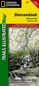
Wandelkaart - Topografische kaart 228 Shenandoah National Park | National Geographic (9781566953658)
Virginia, USA
- ISBN / CODE: 9781566953658
- Editie: 01-09-2022
- Aantal blz.: 1
- Schaal: 1:75000
- Uitgever: National Geographic
- Soort: Topografische kaart, Wandelkaart
- Taal: Engels
- Hoogte: 19.0 cm
- Breedte: 10.0 cm
- Gewicht: 97.0 g
- Uitvoering: Scheur- en watervast
- Schrijf als eerste een review
-
€ 16,95
Leverbaar in 3 - 5 werkdagen in huis in Nederland Levertijd Belgie
Gratis verzending in Nederland vanaf €35,-
-
Overzicht Wandelkaarten Virginia Trails Illustrated National Geographic

.jpg)
Producten op deze overzichtskaart:
Klik op een product om naar de pagina van dat product te gaan.
Overzichtskaarten
Beschrijving
Prachtige geplastificeerde kaart van het nationaal park. Met alle recreatieve voorzieningen als campsites, maar ook met topografische details en wandelroutes ed. Door uitgekiend kleurgebruik zeer prettig in gebruik. Scheur en watervast!
The map includes Shenandoah National Park in its entirety, wilderness areas, Rapidian Wildlife Management Area, Overall Run Waterfall, Whiteoak Canyon Waterfall, Cedar Run Waterfall, Rose River Waterfall, Dark Hollow Waterfall, Lewis Waterfall, South River Waterfall, Doyles River Waterfalls #1 and #1, Jones Run Waterfall, the citis of Front Royal, Waynesboro, Harrisonburg, Shenandoah, Elkton, Grottoes,and Charlottesville, George Washington National Forest, the Appalachian Trail, Shenandoah River, Skyline Drive, and much more. Includes UTM grids for use with your GPS unit.
Reviews
Geen reviews gevonden voor dit product.
Schrijf een review
Graag horen wij wat u van dit artikel vindt. Vindt u het goed, leuk, mooi, slecht, lelijk, onbruikbaar of erg handig: schrijf gerust alles op! Het is niet alleen leuk om te doen maar u informeert andere klanten er ook nog mee!


