Wegenkaart - landkaart Kananaskis Country | Gem Trek Maps (9781990161001)
- ISBN / CODE: 9781990161001
- Editie: 20-06-2023
- Druk: 1
- Aantal blz.: 1
- Schaal: 1:120000
- Uitgever: Gem Trek Maps
- Soort: Wegenkaart
- Serie: Driving maps
- Taal: Engels
- Hoogte: 26.0 cm
- Breedte: 12.0 cm
- Gewicht: 90.0 g
- Uitvoering: Scheur- en watervast
- Bindwijze: -
- Schrijf als eerste een review
-
€ 16,95
Leverbaar in 3 - 5 werkdagen in huis in Nederland Levertijd Belgie
Gratis verzending in Nederland vanaf €35,-

Beschrijving
Van de uitgever
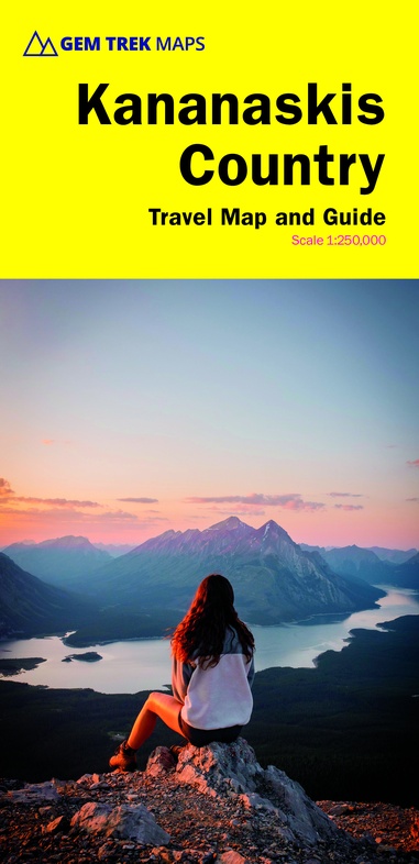
Waterproof and tear-resistant map for Kananaskis Country in the Canadian Rockies.
Whether you are a first-time visitor or a long-time local, you’ll find Gem Trek’s Kananaskis Country Map to be an invaluable tool. Researched and designed by locals, and printed in Canada, this map features accurate cartography and subtly coloured relief that puts the mountainous region in perspective. The map is printed on high-quality synthetic waterproof paper that can be folded and refolded hundreds of times.
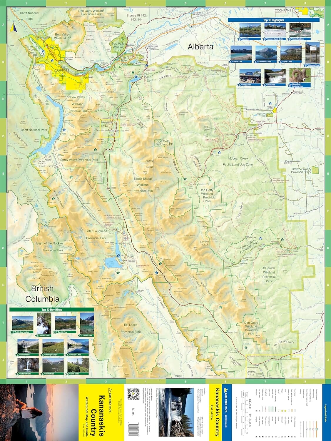
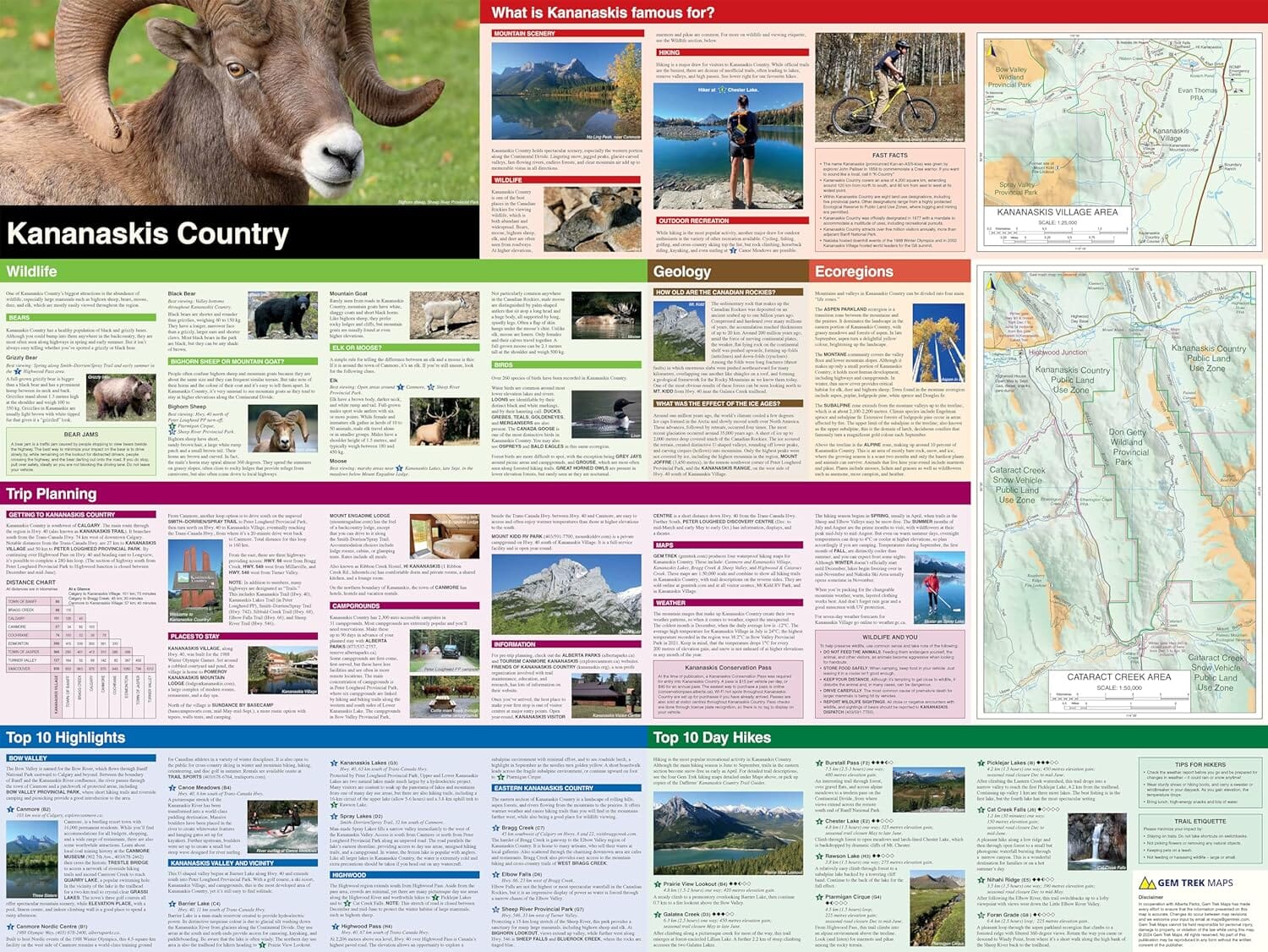
The 1:250,000 scale is ideal for discovering the very best of Kananaskis Country. Highlights and our recommended hiking trails are marked by numbered stars, then cross-referenced on the reverse side with descriptions. Also included are all mountains and their elevations, along with natural features such as waterfalls, rivers, and lakes.
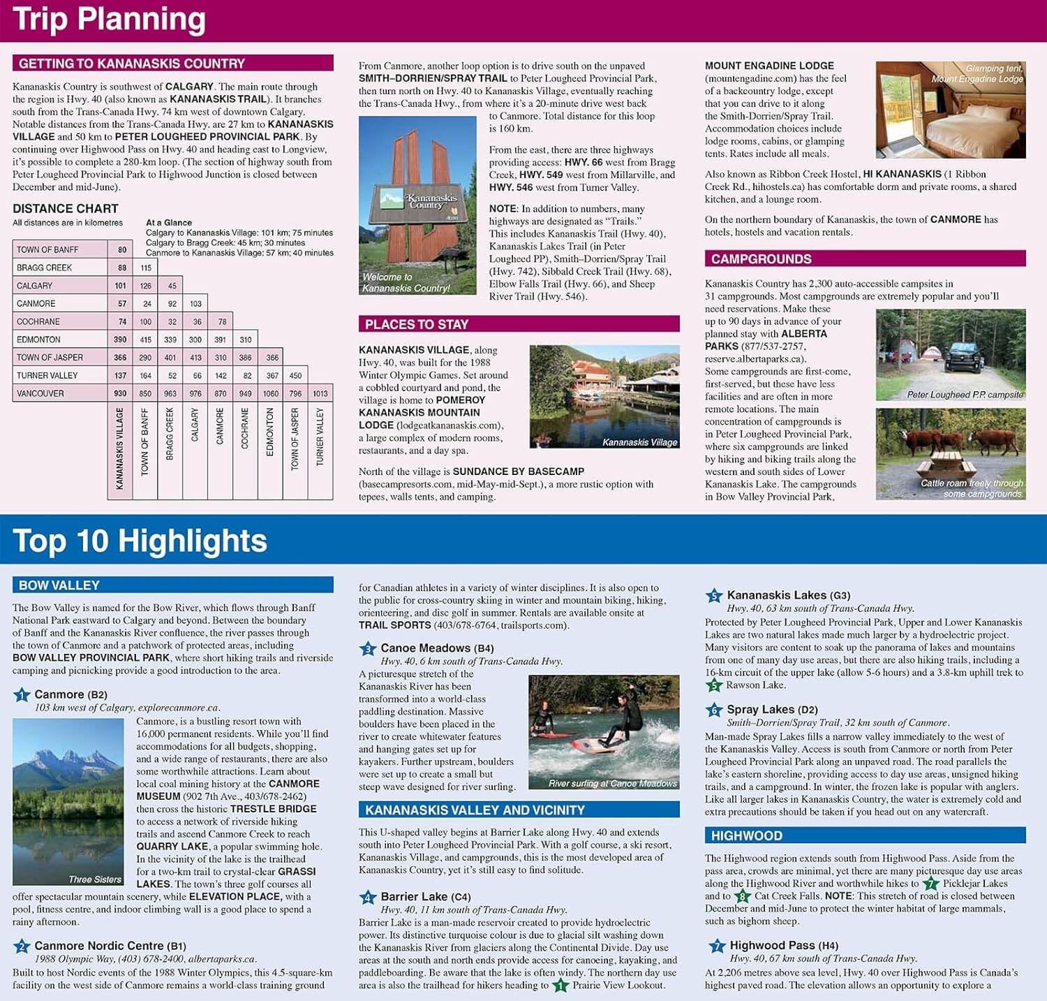
In addition to descriptions for the top highlights and most popular hiking trails, the reverse side has inset maps for Kananaskis Village and the Cataract Creek region. There are also descriptions of the park’s geology, history, wildlife, and eco-regions. Practical information on outdoor activities, weather, campgrounds, lodging, and visitor centres allows map users to plan their trip accordingly.
– Map scale: 1:250,000
– Sheet size: 27 x 39 inches
– Folded size: 4.5 x 9.5 inches
Map Coverage
The Kananaskis Country Map covers all of Kananaskis Country in the Canadian Rockies. Coverage extends from Canmore and the Bow Valley in the north to the Highwood River and Cataract Creek in the south. The Continental Divide and Elk Lakes Provincial Park are covered to the west while eastern coverage extends to Bragg Creek and the Elbow and Sheep River Valleys.
Map Features
The Kananaskis Country Map features:
- waterproof and tear-resistant paper
- relief shading to better show the topography
- full colour on both sides
- hydrology rivers, rapids and waterfalls
- mountain names and all available mountain elevations
- all campgrounds with a handy chart showing campground details
- points of interest and attractions as well as day use areas and highway viewpoints
Reviews
Geen reviews gevonden voor dit product.
Schrijf een review
Graag horen wij wat u van dit artikel vindt. Vindt u het goed, leuk, mooi, slecht, lelijk, onbruikbaar of erg handig: schrijf gerust alles op! Het is niet alleen leuk om te doen maar u informeert andere klanten er ook nog mee!
Ook interessant voor noord-amerika/canada/alberta
-

Wandelgids Canadian Rockies Trail Gu
€ 29,95Wandelgidsen Alberta -

Vogelgids Sibley Field Guide to Bird
€ 25,95Vogelgidsen Alberta -

Reisgids Canadian Rockies, met Banff
€ 20,95Reisgidsen Alberta -

Wandelkaart 13 Best of Lake Louise M
€ 13,95Wandelkaarten Alberta -

Wegenkaart - landkaart British Colum
€ 13,95Wegenkaarten Alberta