Winkelwagen
Geen items in winkelwagen
Ga naar winkelwagen
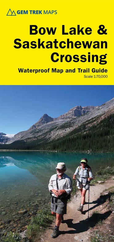
Wandelkaart Bow Lake / Saskatchewan Crossing | Gem Trek Maps (9781990161087)
Includes the Mosquito Creek/Fish Lakes area
- ISBN / CODE: 9781990161087
- Editie: 01-04-2024
- Druk: 6
- Aantal blz.: 1
- Schaal: 1:70000
- Uitgever: Gem Trek Maps
- Soort: Wandelkaart
- Serie: Trail maps
- Taal: Engels
- Hoogte: 24.0 cm
- Breedte: 11.0 cm
- Gewicht: 88.0 g
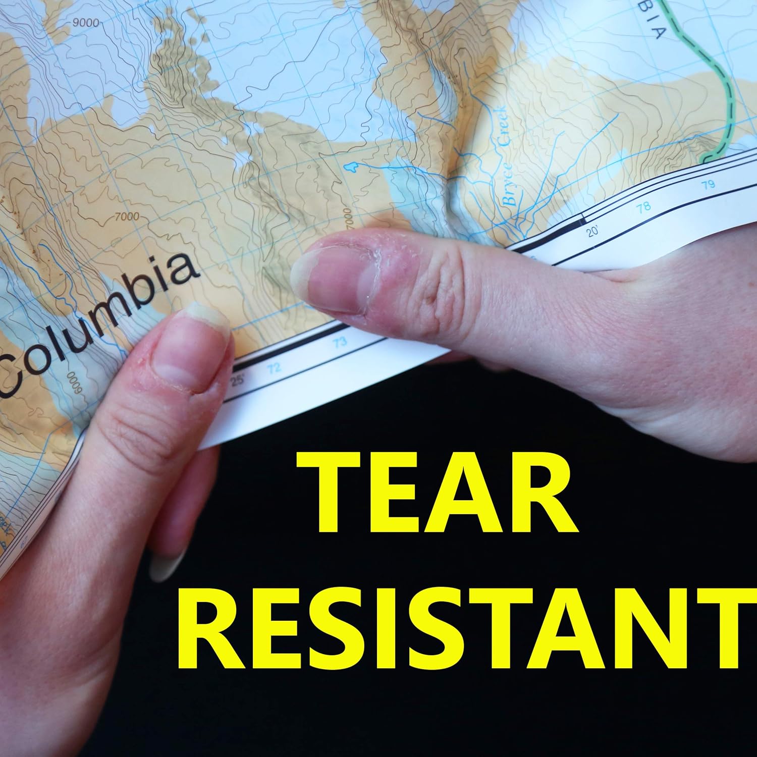
- Uitvoering: Scheur- en watervast
- Bindwijze: -
- Schrijf als eerste een review
-
€ 18,95
Dit artikel is (tijdelijk) niet leverbaar
Beschrijving
Waterproof and tear-resistant hiking and recreation map for the Bow Lake and Saskatchewan Crossing region of Banff National Park.
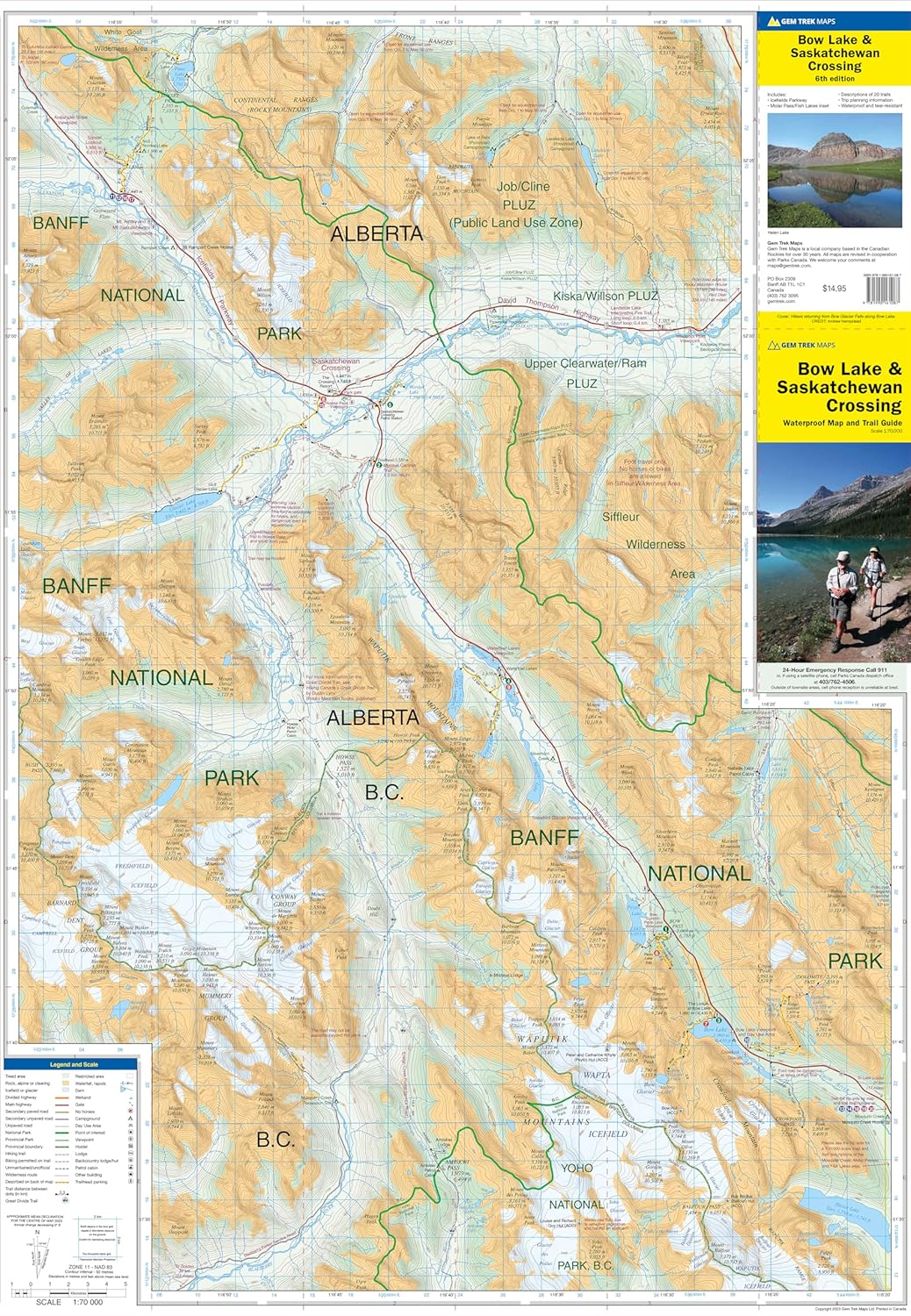
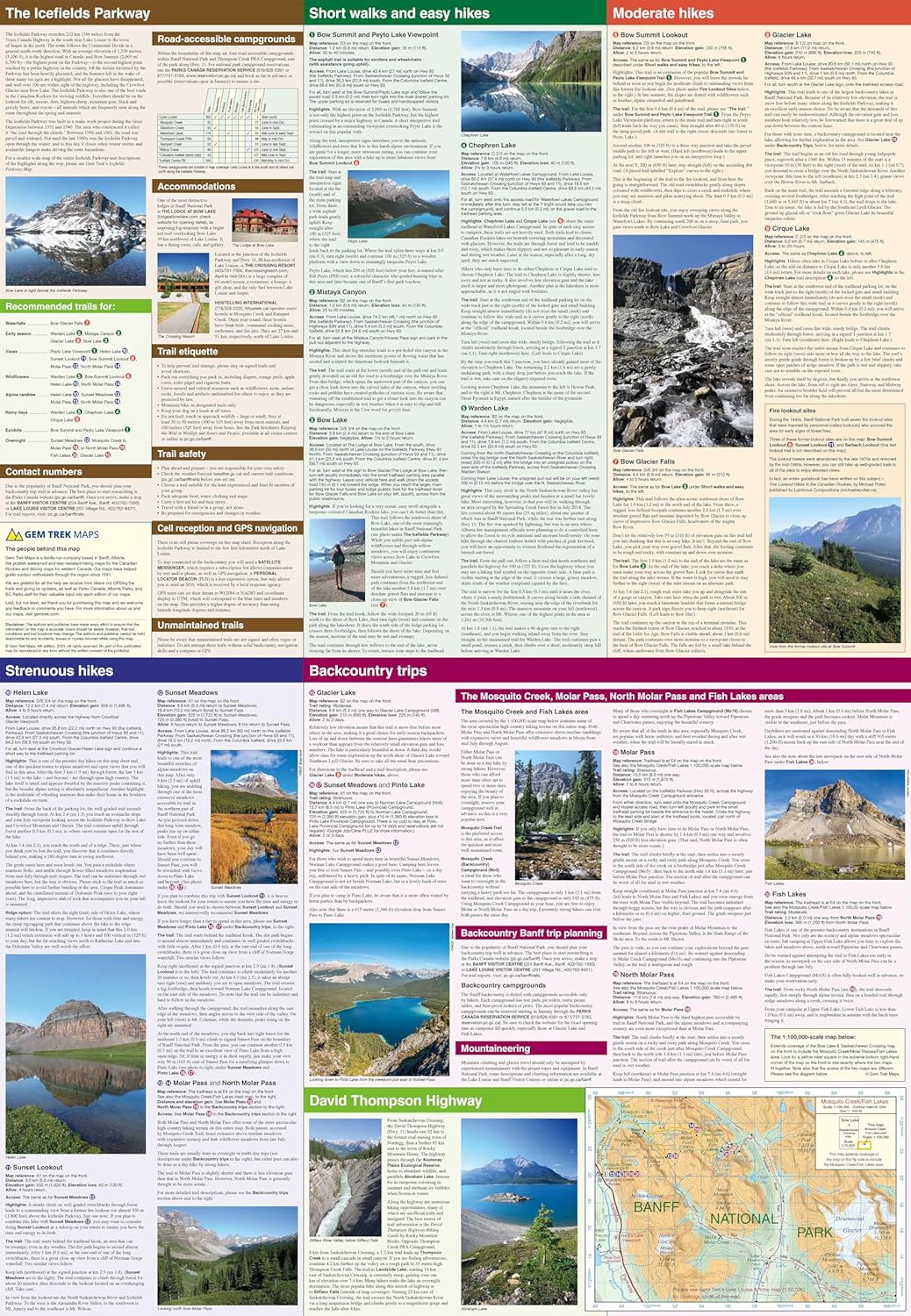
Gem Trek's 1:70,000 Bow Lake and Saskatchewan Crossing Map is designed for outdoor enthusiasts looking to explore the Bow Lake and Saskatchewan Crossing region at the north end of Banff National Park. Whether you are touring along the roads or heading into the backcountry, you’ll find the waterproof and tear-resistant Bow Lake and Saskatchewan Crossing Map to be an invaluable tool. This map features detailed cartography, accurate hiking trails with distances, and details such as logging roads on the British Columbia side of the Continental Divide, campgrounds, picnic areas, and abandoned fire lookouts. On the back are descriptions of 24 recommended hikes, ranging from short walks to overnight treks, as well as details of services such as campgrounds and visitor centres.
Map specs
– Edition: 6th
– Map scale: 1:70,000
– Sheet size: 27 x 39 inches
– Folded size: 4.5 x 9.5 inches
Map coverage
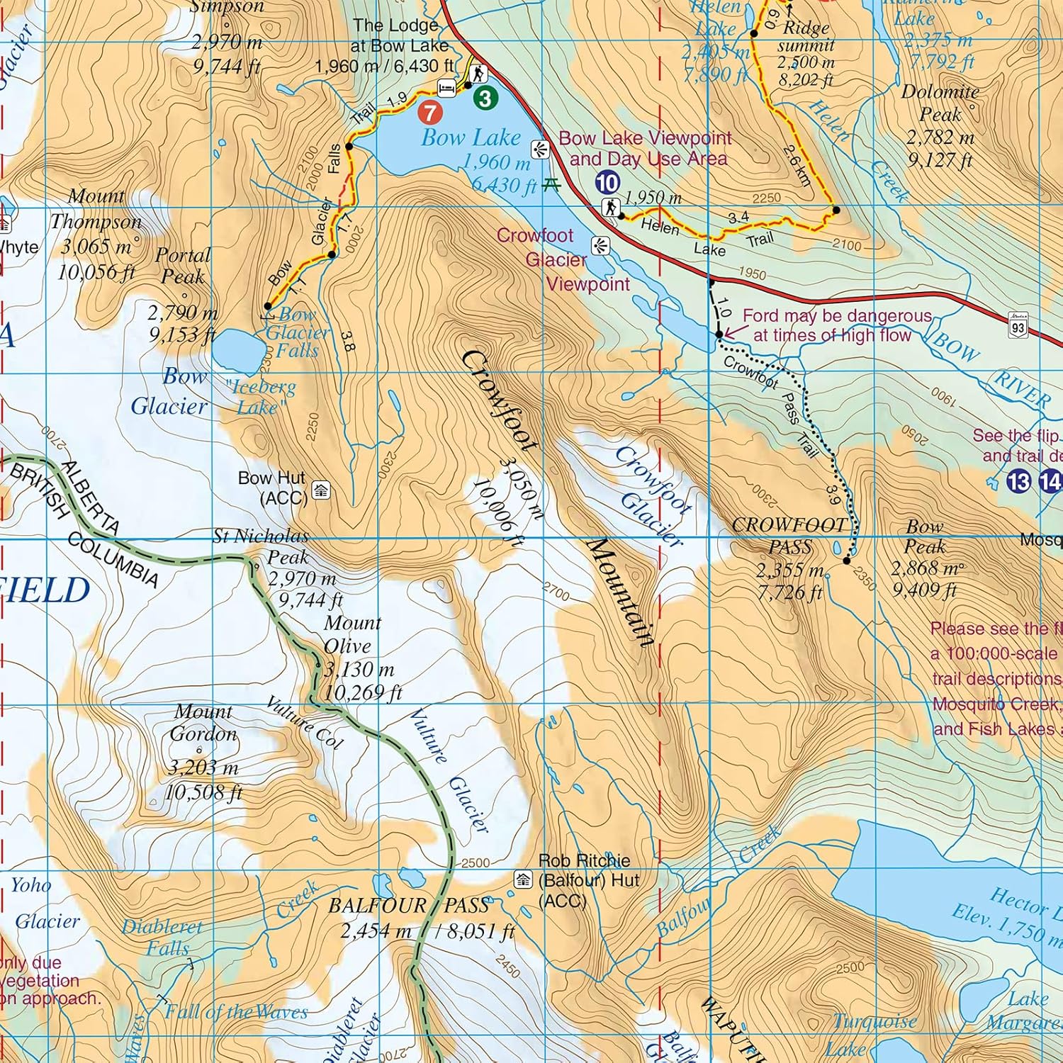
The Bow Lake and Saskatchewan Crossing Map covers the portion of Banff National Park along the Icefields Parkway between Bow Lake in the south and Graveyard Flats in the north. It also includes the Kootenay Plains, which are accessed east of Saskatchewan Crossing along Highway 11. It also includes coverage of the Blaeberry Valley in British Columbia and the historic trading route linking the Blaeberry to the Kootenay Plains via Howse Pass. Popular hiking trails on the Bow Lake and Saskatchewan Crossing Map include Bow Glacier Falls, Helen Lake, Bow Summit Lookout, Sunset Pass, and Cirque Lake, Chephren Lake, and Glacier Lake.
A 1:100,000-scale inset map on the back increases coverage on the east side of the Icefields Parkway in the Mosquito Creek drainage, providing detail for hikers heading to Fish Lakes and Molar Pass.
Map Features
The Bow Lake and Saskatchewan Crossing Map features:
- waterproof and tear-resistant paper
- contour lines at 25-metre (80-foot) intervals
- relief shading to better show the topography
- full colour on both sides
- hiking trails with trail names and trail distances marked
- mountain biking and equestrian trails with trail names and distances marked
- hydrology rivers, rapids and waterfalls
- mountain names and all available mountain elevations
- all campgrounds with a handy chart showing campground details
- points of interest and attractions as well as picnic areas and highway viewpoints
Reviews
Geen reviews gevonden voor dit product.
Schrijf een review
Graag horen wij wat u van dit artikel vindt. Vindt u het goed, leuk, mooi, slecht, lelijk, onbruikbaar of erg handig: schrijf gerust alles op! Het is niet alleen leuk om te doen maar u informeert andere klanten er ook nog mee!
Alle gerelateerde rubrieken >
Ook interessant voor noord-amerika/canada/alberta
-

Reisgids ANWB Wereldreisgids Canada
€ 29,50Reisgidsen Alberta -

Wandelkaart 13 Best of Lake Louise M
€ 13,95Wandelkaarten Alberta -

Wegenatlas Verenigde Staten en Canad
€ 15,99Wegenatlassen Washington (staat) -

Wegenkaart - landkaart Southern Albe
€ 13,95Wegenkaarten Alberta -

Wandelgids Kanadische Rocky Mountain
€ 22,50Wandelgidsen Alberta