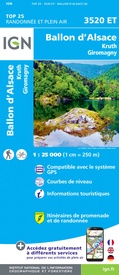
Wandelkaart - Topografische kaart 3520ET Ballon d'Alsace | IGN - Institut Géographique National (9782758550266)
Kruth Giromagny PNR des Ballons des Vosges
- ISBN / CODE: 9782758550266
- Editie: 02-03-2020
- Druk: 4
- Aantal blz.: 1
- Schaal: 1:25000
- Uitgever: IGN - Institut Géographique National
- Soort: Topografische kaart, Wandelkaart
- Serie: Top 25
- Taal: Frans
- Hoogte: 24.0 cm
- Breedte: 11.0 cm
- Gewicht: 87.0 g
- Uitvoering: Papier
- Bindwijze: -
- Beoordeling: 4,3 ★★★★★ ★★★★★ (3 reviews) Schrijf een review
-
€ 16,95
Op voorraad. Binnen 2 - 3 werkdagen in huis in Belgie Levertijd Nederland
-
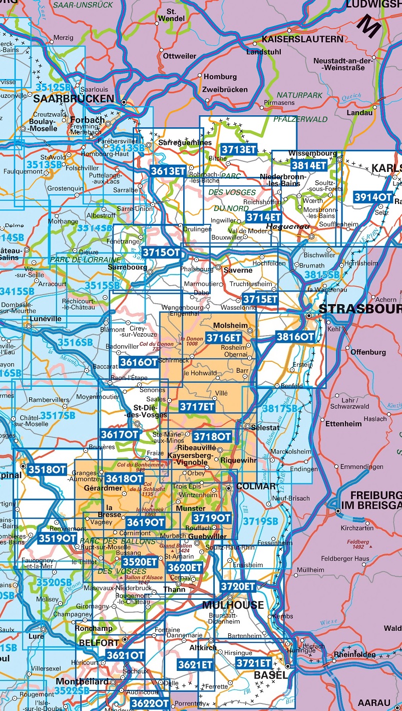
Overzicht IGN 25.000 Vogezen en Elzas - Lotharingen: Oost


Producten op deze overzichtskaart:
Klik op een product om naar de pagina van dat product te gaan.
- Wandelkaart - Topografische kaart 3518OT Epinal | IGN - Institut Géographique National
- Wandelkaart - Topografische kaart 3519OT Remiremont | IGN - Institut Géographique National
- Wandelkaart - Topografische kaart 3520ET Ballon d'Alsace | IGN - Institut Géographique National
- Wandelkaart - Topografische kaart 3613ET Sarreguemines | IGN - Institut Géographique National
- Wandelkaart - Topografische kaart 3614ET Sarre-Union - Phalsbourg | IGN - Institut Géographique National
- Wandelkaart - Topografische kaart 3616OT Lac de Pierre-Percée - Le Donon | IGN - Institut Géographique National
- Wandelkaart - Topografische kaart 3617OT St-Dié-des-Vosges | IGN - Institut Géographique National
- Wandelkaart - Topografische kaart 3618OT Le Hohneck - Gérardmer | IGN - Institut Géographique National
- Wandelkaart - Topografische kaart 3619OT Bussang - La Bresse | IGN - Institut Géographique National
- Wandelkaart - Topografische kaart 3620ET Grand Ballon | IGN - Institut Géographique National
- Wandelkaart - Topografische kaart 3621ET Dannemarie - Delle - Sundgau | IGN - Institut Géographique National
- Wandelkaart - Topografische kaart 3713ET Pays de Bitche - Dambach - PNR des Vosges du Nord | IGN - Institut Géographique National
- Wandelkaart - Topografische kaart 3714ET la Petite Pierre - Petite Pierre, Niederbronn-les-Bains, PNR Vosges du Nord | IGN - Institut Géographique National
- Wandelkaart - Topografische kaart 3715ET Wasselone - Rocher de Dabo - Saverne | IGN - Institut Géographique National
- Wandelkaart - Topografische kaart 3715OT Sarrebourg - Phalsbourg - Pays des Etangs | IGN - Institut Géographique National
- Wandelkaart - Topografische kaart 3716ET le Donon, Obernai, Mont Ste-Odile | IGN - Institut Géographique National
- Wandelkaart - Topografische kaart 3717ET Barr - Le Howald - Villé - Vallée de la Bruche | IGN - Institut Géographique National
- Wandelkaart - Topografische kaart 3717ETR Barr / Le Howald / Villé / Hte Vallée de la Bruche | IGN - Institut Géographique National
- Wandelkaart - Topografische kaart 3718OT Selestat - Col Du Bonhomme | IGN - Institut Géographique National
- Wandelkaart - Topografische kaart 3719 SB - Serie Bleue Colmar | IGN - Institut Géographique National
- Wandelkaart - Topografische kaart 3719OT Colmar & Le Hohneck | IGN - Institut Géographique National
- Wandelkaart - Topografische kaart 3720ET Mulhouse | IGN - Institut Géographique National
- Wandelkaart - Topografische kaart 3721ET Altkirch - Bâle - Sundgau | IGN - Institut Géographique National
- Wandelkaart - Topografische kaart 3814ET Hagenau - Lembach - PNR des Vosges du Nord | IGN - Institut Géographique National
- Wandelkaart - Topografische kaart 3815 SB - Serie Bleue Bischwiller - Brumath | IGN - Institut Géographique National
- Wandelkaart - Topografische kaart 3816OT Strasbourg | IGN - Institut Géographique National
- Wandelkaart - Topografische kaart 3817 SB - Serie Bleue Sélestat - Marckolsheim | IGN - Institut Géographique National
- Wandelkaart - Topografische kaart 3914OT Wissembourg | IGN - Institut Géographique National
-
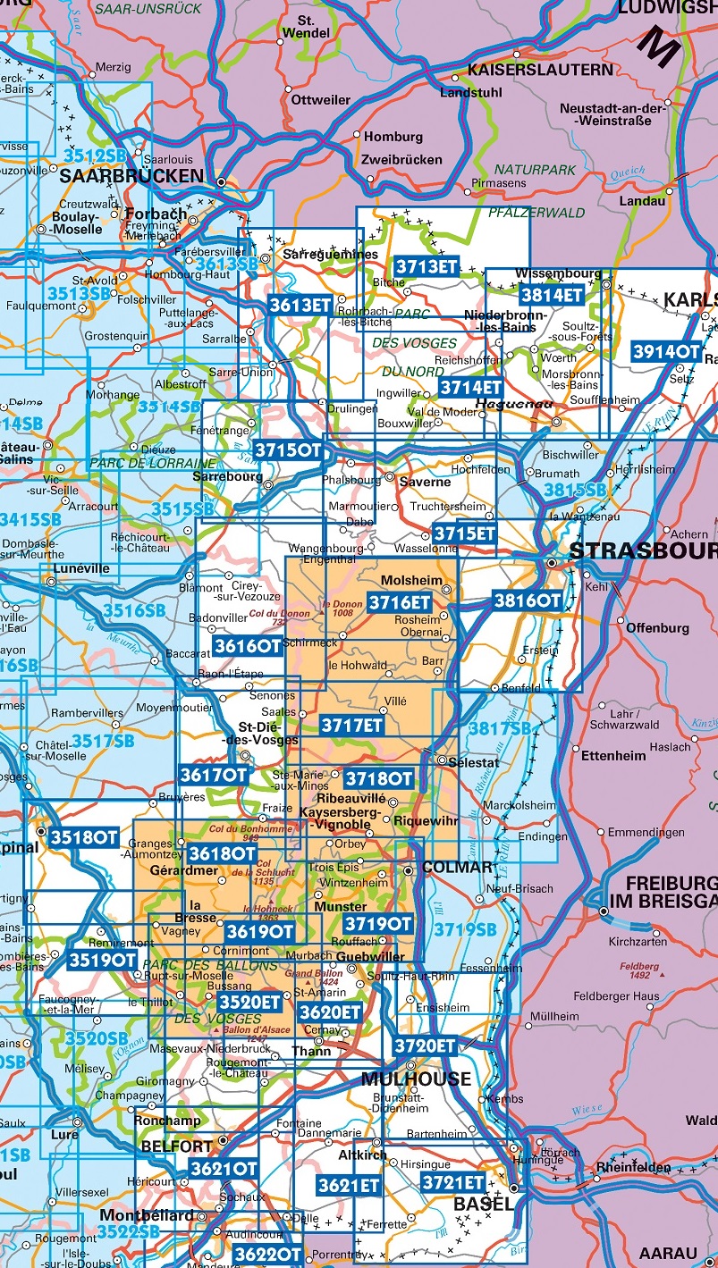
Overzicht IGN 25.000 Vogezen en Elzas - Lotharingen: Oost


Producten op deze overzichtskaart:
Klik op een product om naar de pagina van dat product te gaan.
- Wandelkaart - Topografische kaart 3518OT Epinal | IGN - Institut Géographique National
- Wandelkaart - Topografische kaart 3519OT Remiremont | IGN - Institut Géographique National
- Wandelkaart - Topografische kaart 3520ET Ballon d'Alsace | IGN - Institut Géographique National
- Wandelkaart - Topografische kaart 3613ET Sarreguemines | IGN - Institut Géographique National
- Wandelkaart - Topografische kaart 3614ET Sarre-Union - Phalsbourg | IGN - Institut Géographique National
- Wandelkaart - Topografische kaart 3616OT Lac de Pierre-Percée - Le Donon | IGN - Institut Géographique National
- Wandelkaart - Topografische kaart 3617OT St-Dié-des-Vosges | IGN - Institut Géographique National
- Wandelkaart - Topografische kaart 3618OT Le Hohneck - Gérardmer | IGN - Institut Géographique National
- Wandelkaart - Topografische kaart 3619OT Bussang - La Bresse | IGN - Institut Géographique National
- Wandelkaart - Topografische kaart 3620ET Grand Ballon | IGN - Institut Géographique National
- Wandelkaart - Topografische kaart 3621ET Dannemarie - Delle - Sundgau | IGN - Institut Géographique National
- Wandelkaart - Topografische kaart 3713ET Pays de Bitche - Dambach - PNR des Vosges du Nord | IGN - Institut Géographique National
- Wandelkaart - Topografische kaart 3714ET la Petite Pierre - Petite Pierre, Niederbronn-les-Bains, PNR Vosges du Nord | IGN - Institut Géographique National
- Wandelkaart - Topografische kaart 3715ET Wasselone - Rocher de Dabo - Saverne | IGN - Institut Géographique National
- Wandelkaart - Topografische kaart 3715OT Sarrebourg - Phalsbourg - Pays des Etangs | IGN - Institut Géographique National
- Wandelkaart - Topografische kaart 3716ET le Donon, Obernai, Mont Ste-Odile | IGN - Institut Géographique National
- Wandelkaart - Topografische kaart 3717ET Barr - Le Howald - Villé - Vallée de la Bruche | IGN - Institut Géographique National
- Wandelkaart - Topografische kaart 3717ETR Barr / Le Howald / Villé / Hte Vallée de la Bruche | IGN - Institut Géographique National
- Wandelkaart - Topografische kaart 3718OT Selestat - Col Du Bonhomme | IGN - Institut Géographique National
- Wandelkaart - Topografische kaart 3719 SB - Serie Bleue Colmar | IGN - Institut Géographique National
- Wandelkaart - Topografische kaart 3719OT Colmar & Le Hohneck | IGN - Institut Géographique National
- Wandelkaart - Topografische kaart 3720ET Mulhouse | IGN - Institut Géographique National
- Wandelkaart - Topografische kaart 3721ET Altkirch - Bâle - Sundgau | IGN - Institut Géographique National
- Wandelkaart - Topografische kaart 3814ET Hagenau - Lembach - PNR des Vosges du Nord | IGN - Institut Géographique National
- Wandelkaart - Topografische kaart 3815 SB - Serie Bleue Bischwiller - Brumath | IGN - Institut Géographique National
- Wandelkaart - Topografische kaart 3816OT Strasbourg | IGN - Institut Géographique National
- Wandelkaart - Topografische kaart 3817 SB - Serie Bleue Sélestat - Marckolsheim | IGN - Institut Géographique National
- Wandelkaart - Topografische kaart 3914OT Wissembourg | IGN - Institut Géographique National
Overzichtskaarten
Beschrijving
Reviews
Zonder zo’n gedetailleerde kaart verdwaal je gemakkelijk. Nu zijn de routes die ook staan aangegeven goed te lopen.
★★★★★ door Hans van Dijk 14 september 2023 | Heeft dit artikel gekochtVond u dit een nuttige review? (login om te beoordelen)
prima kaart
★★★★★ door Renske Schasfoort 15 juli 2013Vond u dit een nuttige review? (login om te beoordelen)
Deze serie kaarten is erg handig voor het maken van wandelingen. Door de duidelijke hoogtelijnen kun je erg goed je eigen wandelroute bepalen.
★★★★★ door J.P. van Dijk-Brinkhuis 16 maart 2013Vond u dit een nuttige review? (login om te beoordelen)
Schrijf een review
Graag horen wij wat u van dit artikel vindt. Vindt u het goed, leuk, mooi, slecht, lelijk, onbruikbaar of erg handig: schrijf gerust alles op! Het is niet alleen leuk om te doen maar u informeert andere klanten er ook nog mee!


