Wandelkaart Cumbria Way | Harvey Maps (9781851374243)
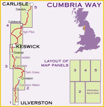
Ulverston to Carlisle
- ISBN / CODE: 9781851374243
- Editie: 01-09-2023
- Aantal blz.: 1
- Schaal: 1:40000
- Uitgever: Harvey Maps
- Soort: Wandelkaart
- Serie: National Trail Maps
- Taal: Engels
- Hoogte: 25.0 cm
- Breedte: 14.0 cm
- Gewicht: 74.0 g
- Uitvoering: Scheur- en watervast
- Bindwijze: -
- Schrijf als eerste een review
-
€ 25,95
Op voorraad. Voor 17.00 uur op werkdagen besteld, morgen in huis in Nederland Levertijd Belgie
Gratis verzending in Nederland vanaf €35,-


-
Overzicht National Trail Maps Harvey Maps
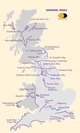
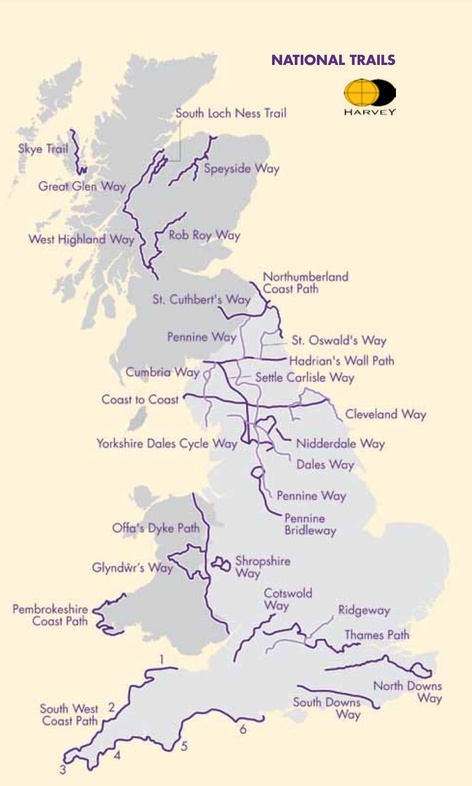
Producten op deze overzichtskaart:
Klik op een product om naar de pagina van dat product te gaan.
- Wandelkaart 1 South West Coast Path 1 | Harvey Maps
- Wandelkaart 3 South West Coast Path 3 | Harvey Maps
- Wandelkaart Affric Kintail Way | Harvey Maps
- Wandelkaart Anglesey Coastal Path | Harvey Maps
- Wandelkaart Cape Wrath Trail North | Harvey Maps
- Wandelkaart Cape Wrath Trail South | Harvey Maps
- Wandelkaart Cleveland Way | Harvey Maps
- Wandelkaart Coast to Coast | Harvey Maps
- Wandelkaart Cotswold Way | Harvey Maps
- Wandelkaart Cumbria Way | Harvey Maps
- Wandelkaart Dales Way | Harvey Maps
- Wandelkaart East Highland Way | Harvey Maps
- Wandelkaart Fife Coastal Path | Harvey Maps
- Wandelkaart Glyndwr's Way | Harvey Maps
- Wandelkaart Great Glen Way | Harvey Maps
- Wandelkaart Hadrian's Wall | Harvey Maps
- Wandelkaart John O'Groats trail | Harvey Maps
- Wandelkaart North Downs Way | Harvey Maps
- Wandelkaart Northumberland Coast Path and Berwickshire Coastal Path | Harvey Maps
- Wandelkaart Offa's Dyke Path | Harvey Maps
- Wandelkaart Peddars Way & Norfolk Coast Path | Harvey Maps
- Wandelkaart Pennine Bridleway | Harvey Maps
- Wandelkaart Pennine Way North | Harvey Maps
- Wandelkaart Pennine Way South | Harvey Maps
- Wandelkaart - Fietskaart Ridgeway | Harvey Maps
- Wandelkaart Rob Roy Way | Harvey Maps
- Wandelkaart Settle to Carlisle Way | Harvey Maps
- Wandelkaart Shropshire Way | Harvey Maps
- Wandelkaart Skye Trail | Harvey Maps
- Wandelkaart - Fietskaart South Downs Way | Harvey Maps
- Wandelkaart South Loch Ness Trail | Harvey Maps
- Wandelkaart South West Coast Path 2 | Harvey Maps
- Wandelkaart Southern Upland Way | Harvey Maps
- Wandelkaart Speyside Walk (Schotland) | Harvey Maps
- Wandelkaart St Cuthbert's Way | Harvey Maps
- Wandelkaart St Oswald's Way | Harvey Maps
- Wandelkaart Thames Path | Harvey Maps
- Wandelkaart The Great Trossachs Path | Harvey Maps
- Wandelkaart Two Moors Way | Harvey Maps
- Wandelkaart Wales Coast Path 1 | Harvey Maps
- Wandelkaart Wales Coast Path 2 | Harvey Maps
- Wandelkaart Wales Coast Path 3 | Harvey Maps
- Wandelkaart Wales Coast Path 4 | Harvey Maps
- Wandelkaart West Highland Way | Harvey Maps
Overzichtskaarten
Beschrijving
Duidelijke kaart van de Cumbria Way met veel extra informatie.
Cumbria Way Map XT40 edition
Leap forward in technical excellence. Tough, light and 100% wateproof
Compact and light - the map itself weighs just 60gms - a third of the weight of a laminated map, and much less bulky. And you can fold or refold it time and again, or stuff it in your back pocket and it won't fall to pieces. Shows the entire route on one sheet.
The Cumbria Way is 112km (70 miles) from Ulverston to Carlisle. It passes through Coniston, Dungeon Ghyll, Keswick and Caldbeck. Mostly through valleys rather than over high tops.
Information on finding accommodation, camping, food. Directions to the start. Also Ranger Service contact numbers and enlargements of towns/villages showing facilities available and tips on weather and clothing
Detailed mapping, full legend. National Grid - can be used with GPS. 1:40,000 scale. Waterproof. Supplied in clear plastic pocket
Reviews
Geen reviews gevonden voor dit product.
Schrijf een review
Graag horen wij wat u van dit artikel vindt. Vindt u het goed, leuk, mooi, slecht, lelijk, onbruikbaar of erg handig: schrijf gerust alles op! Het is niet alleen leuk om te doen maar u informeert andere klanten er ook nog mee!
Ook interessant voor europa/engeland/north-west-england
-

Fietsgids Lost Lanes North | Wild Th
€ 23,95Fietsgidsen North East England -

Fietskaart mountainbike Coast to Coa
€ 28,50Fietskaarten Yorkshire and the Humber -

Reisverhaal In mijn voetsporen | Co
€ 22,99Reisverhalen North East England -

Wandelatlas Hadrian's Wall Path Map
€ 17,95Wandelatlassen North East England -

Wandelgids Walking in Cumbria's Eden
€ 18,50Wandelgidsen North West England