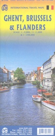
Stadsplattegrond Gent / Brussel / Vlaanderen | ITMB (9781771293242)
- ISBN / CODE: 9781771293242
- Editie: 12-07-2023
- Druk: 1
- Aantal blz.: 1
- Schaal: 1:9000
- Uitgever: ITMB
- Soort: Stadsplattegrond
- Taal: Engels
- Hoogte: 25.0 cm
- Breedte: 10.0 cm
- Gewicht: 55.0 g
- Uitvoering: Papier
- Bindwijze: -
- Schrijf als eerste een review
-
€ 14,50
Leverbaar in 3 - 5 werkdagen in huis in Nederland Levertijd Belgie
Gratis verzending in Nederland vanaf €35,-
Beschrijving
Van de uitgever
Stadsplattegrond Gent en Brussel, Wegenkaart Vlaanderen
Ghent is one of the most historic cities in Europe. A city of canals, it became wealthy during the Middle Ages by controlling the production of cloth over several centuries. It is full of historic buildings and desperately needs a map or one becomes lost in the narrow streets that fill the ancient city centre. However, Ghent is not all that big so we have combined it with a detailed map of Brussels, the nominal capital of Belgium and the location of the European Union HQ. It was also the site of the famous world fair in 1968, the legacy of which is the Giant Atomium. Side 2 of the map is also a new venture for us; a detailed map of Flanders region from Liege to Lille and from south of Brussels to north of Antwerp. This portion of both France and Belgium is full of historical importance and we hope to develop this artwork in future editions. For now, it is a detailed road map showing many fortresses/castles and monuments. Map size when unfolded: 27*39" Legend Includes: Roads by classification, Rivers and Lakes, National Park, Airports, Points of Interests, Highways, Main Roads, Zoos, Fishing, and much more..
Reviews
Geen reviews gevonden voor dit product.
Schrijf een review
Graag horen wij wat u van dit artikel vindt. Vindt u het goed, leuk, mooi, slecht, lelijk, onbruikbaar of erg handig: schrijf gerust alles op! Het is niet alleen leuk om te doen maar u informeert andere klanten er ook nog mee!


